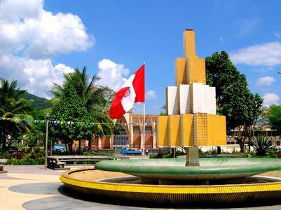
Satipo, Ecological Capital of the Central Jungle


Satipo, Junín, Peru
Satipo, Ecological Capital of the Central Jungle
Satipo, Ecological Capital of the Central Jungle
Suggest Place to Visit
527
Track to location with GPS |
 |
Among the first settlers we find diverse communities of natives such as Asháninkas, Amuishas, Piros, Nomatsiguengas, Simirinches, Amewakas, Cakintis, etc. that have left us their legacy through the many petroglyphs that are scattered throughout the province, which are believed to be 1500 years old. Unfortunately there are no scientific studies to confirm this information.
There are also remains of ceramics, stone and gold axes, as well as stone constructions that indicate the Inca presence in these territories, confirming the popular versions that the Incas tried to conquer the Satipan jungle, but faced the determined determination of the Ashaninka natives not to allow the invasion of their territories.
This rich territory is none other than the one known as Gran Pajonal, which is an inter-river plateau located in the common territory of the departments of Ucayali, Pasco and Junín. Its natural limits are the Pichis and Pachitea rivers to the north, the Ucayali to the east, the Perené and the Tambo to the south; and the Andes mountain range to the west. It is rugged and has an altitude of 800 to 2000 meters, strong cloud cover and low forests of very high biodiversity. It is the historical territory of the Asháninka.
The Asháninkas are precisely the most important indigenous group in the Peruvian Amazon, according to the information in the 1993 census (these results of the 2005 Census have not yet been published); 52,461 people representing 21.89% of the total population registered. In the census records, however, an important omission of the population located in the basins of the Ene and Tambo rivers is estimated, whose area could not be adequately surveyed due to the political violence prevailing in that year.
The Asháninka people live in the central Peruvian jungle, an Amazon region that rises to the folds of the Andes mountain range. Here the rivers descend in small threads to become mighty flows that carry the humus of the highlands to the jungle.
For centuries the entire region was inhabited mainly by the Asháninka and by other communities such as the Yaneshas with whom they shared a vast territory fertile for agriculture and abundant in animal species. Just in the early 1900s, the arrival of an increasingly aggressive colonization was causing the Asháninka to enter into a permanent relationship with the colonists and thus also with their technologies, symbols and beliefs. Religious and commercial groups were the first to settle permanently in the region. A good part of the population embraced the Adventist religion and under that belief they put aside the traditions that previously marked their social relationships and daily life.
The second Chief of the Colony was Don José Carlos Chirif, he lasted a few months in office.
In 1931, Mr. Antonio Scavino was appointed chief, also for a short time.
In 1932, Don Juan Elías Lobatón was the chief, infamous for his scandalous drunkenness.
On October 20, 1932, the government of Sánchez Cerro issued Law_7609, authorizing the Executive Power to enter into contracts for road construction, mineral exploitation and mountain colonization.
In January 1933, the Sánchez Cerro government sent a batch of political, Aprista and Communist prisoners to Satipo, under the custody of the Republican Guard. Sánchez Cerro was assassinated by an Aprista militant in Lima on April 30, 1933, the government of Oscar R. Benavides (1933-1939) released these prisoners that same year; many of whom stayed in Satipo.
On December 3, 1934, in the government of Oscar R. Benavides, Law 7935 was issued, authorizing the Executive Power a supplementary credit to item No.123 of the General Budget Promotion Sheet, to finish the highway to Puerto Ocopa.
In 1935, in January, while Satipo was going through his darkest days of misery, another contingent of political prisoners with the Republican Guard was sent and the new Head of the Colony was appointed Don Emilio Blanco Ara with fourteen employees, including Eng. Raúl Parrau who drew up the new plan of the town of Satipo, which with very little difference is the current one.
At the end of that year, the prisoners were transferred again to El Frontón in Callao, in view of the numerous escapes that took place, because already at that time, the police did not carry out their work correctly despite being a small town. No more prisoners from other cities were ever sent to Satipo.
In 1936 the Municipal Agency of Satipo was created, the first mayor being Don Augusto Hilser. The Agency functioned as a District Council with delegates from various sectors of the neighborhood, acting as secretary Teodoro_Noriega. During this time the municipal premises was built, which was preserved until 1964.
The Satipo Experimental Farm and Colonos School was established, which was inaugurated with great pomp on October 12, 1936, its first head and at the same time Head of the Colony being Eng. Manuel Sánchez del Aguila. The Escuela de Colonos operated for only two years.
In 1937 the first landing field was opened.
On November 18, 1937, the government of Oscar R. Benavides issued Law_8597, authorizing the Ministry of Finance to open an extraordinary loan in the development document for the acquisition of cattle in the entire mountain region, thus supporting the local population.
Applying the last Law, on August 4, 1938, the government of Oscar R. Benavides issued Law_8709, authorizing the Ministry of Finance to open an extraordinary credit for S /. 10,000.00 for the purchase of livestock for the Franciscan missionaries of the Gran Pajonal.
On December 15, 1938, the government of Oscar R. Benavides issued Law_8796, creating in the Ministry of Development the ´´Mountain Land and Colonization Directorate´´ to dedicate itself exclusively to solving all problems related to the exploitation of the mountain region, which thanks to the construction of more roads the area became more attractive for agricultural, mining and livestock exploitation.
Continuing with its support for the Franciscan missionaries, on November 16, 1939, the government of Oscar R. Benavides issued Law_9004, giving an extraordinary credit for S /. 3,380.00 for the purchase of livestock for the Franciscan missionaries of the Gran Pajonal.
At the end of 1939 the highway to Satipo ends and the first vehicle enters, thus speeding up the colonization process.
On September 18, 1940 the "District of Satipo" was created, in the Government of Manuel Prado Ugarteche (1939-1945), with Law_9171, as part of the Province of Jauja and composed of the following towns: Satipo, La Victoria, Santa Ana, Mariposa, Pampa Hermosa, Santo Domingo, Santiago, Río Negro and Puerto Ocopa.
The city of Satipo is located on the left bank of the Satipo River and in the eastern part of the Junín Region at 440 km. east of Lima.
It is located at 632 meters above sea level, varying the ecological levels of the province from 400 meters above sea level. from Puerto Prado (Río Tambo) to 1400 meters above sea level. of Mariposa (Pampa Hermosa).
It covers an area of 19,219.48 km2, 43.5% of the Junín region. It is made up of the valleys that form the rivers: Satipo, Ene, Perené, Tambo and Pangoa.
The main economic activity lies in the production of coffee, cocoa and various fruit trees, such as bananas, papaya and mainly oranges, being considered the best quality in Peru.
From its beginning on the eastern slopes of the Andes, tropical vegetation dominates the landscape, extending uninterruptedly along the Amazon plain.
Possessing extraordinary natural wealth, it is a land of forests and meandering rivers that serve as a means of communication between the peoples that inhabit it.
Río Negro: About 10 minutes from the City, it is one of the districts of the Province of Satipo, in its jurisdiction there are many waterfalls, one of them Tsomontonari.
Tourist Recreation: Typical places of recreation and leisure.
Fundo Verde: Just 15 minutes from Satipo, at Km. 08 of the Satipo-Mazamari road. Place for citrus fruits like oranges, tangerines, tangelos, coconuts and other fruits. Indicated for agritourism, experiential tourism (daily life) and trekking.
Bosque Verde: Private Conservation Area, located within the domains of the Fundo Verde, just 15 minutes from the City of Satipo. Suitable for exploration, observation of wild birds, animals, insects, butterfly watching and educational tourism activities in entomology.
Our waterfalls: Tsomontonari, Santa María, Gallito de las Rocas, Arcoiris, Meretari, Koari and others.
Native Community: Human group of tribes such as the Campas or Ashaninkas. These communities live faithful to their customs and traditions, in harmony with the environment, these communities manufacture handicrafts based on ecological material, typical dances and forms of their own life.
Mazamari: One of the districts of the Province of Satipo, starting point for Puerto Chata, Puerto Ocopa and San Martín de Pangoa.
Puerto Chata and Puerto Ocopa: Typical places of fluvial nature, ecological houses based on organic material from the jungle, typical meals based on river fish and bush meat, boat rides, bird watching, Meretari waterfall and koari , walks, birdwatching, butterfly watching, and visits to native communities.
San Martin de Pangoa: One of the districts of the Province of Satipo, of native communities and places of natural recreation on the banks of the river.
Comments
We don´t have yet any comments about:
Satipo, Ecological Capital of the Central Jungle
Satipo, Ecological Capital of the Central Jungle
Be the first to leave a comment as it is very important to inform other people
Outros locais a visitar
Within a radius of 20 km from:Satipo, Ecological Capital of the Central Jungle
Unfortunately we do not have information on other places to visit in this area yet
Hotel reservation near Satipo, Ecological Capital of the Central Jungle within a radius of 20 km
No results
Why to book with CLUBE TRAVEL
The best prices
Our partnerships with the world´s largest operators offer research on the best market prices.
More options
At Rotas Turisticos you can book the hotel, buy the air ticket, book the transfer from the airport to the hotel and vice versa, book the local excursions, rent the car, take travel insurance and consult the places to visit and where to go.
Holiday Tips & Destinations
Hundreds of holiday destinations with all the options that allow you to easily choose the destination that best suits your dream vacation.
CLUBE TRAVEL
Links
Follow us on social networks


